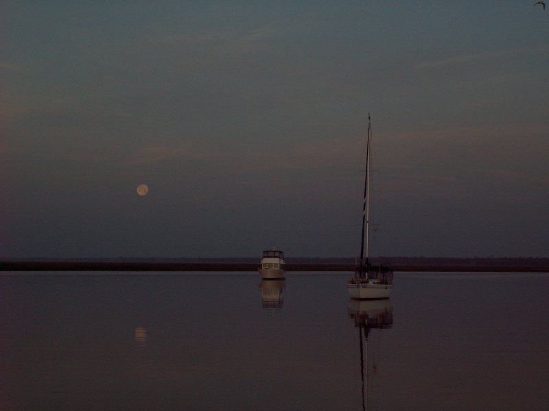
April 29, 2010 - Day 14

Big moon shining all night gave us a beautiful view of the anchorage. It also helped us keep our visual location reference points. Two other boats with us in the anchorage overnight, one trawler and one sailboat. The wind died way down late in the evening so we had a peaceful night. This morning however, we had a little bit of fog. I got these great pictures of the moon setting and the sun rising within minutes of each other. We delayed our start a little, but we were underway at 0815 headed for the scenic Waccamaw River and Myrtle Beach.
We got some boost from the current until we reached Winyah Bay. From there we fought the strong current coming down the Waccamaw. The wind was light and from dead astern until late in the afternoon. By the time the wind began to increase, we decided to stop short of our goal and anchor in Thouroghfare Creek to take advantage of the trees that provided some wind protection there.

We shared the anchorage with one other sailboat. We dropped the hook about 1615 and found out why its called “Thoroughfare”. There was lots of local traffic running between the Waccamaw River and the Great Pee Dee River plus the usual local fishermen, skiers and jet skis.

Thankfully, the wind and traffic died a little after sundown and we had a quiet evening.


Location: Thoroughfare Creek, SC - MM 389 (N of Georgetown, SC)
Distance Traveled: 47 miles

April 28, 2010 - Day 13

Today was full of adventures. We get underway at 0700. A little boost from the current helped us reach Elliotts Cut ahead of schedule. We shot through the cut on the ebbing current and then had to slow down to time the passage through the Wappoo Creek Bridge. While waiting for the bridge, we were boarded by the "coasties". The did their usual Q&A check and inspected for the required safety equipment. We passed. They got off the boat just in time for us to make the bridge opening.


We had a great run through the Charleston Harbor. After that it was skinny water almost all the way to our anchorage . We bumped bottom several times and went real slow searching for the deeper water. We happened upon a boat hard aground after the Ben Sawyer Bridge.  Don't know if he got out of the channel and ran aground or if he tried to anchor overnight and drifted into the shallows. Six to eight foot tide swings are nothing to take lightly. The fellow ran behind the boat when he saw Donna taking pictures.  I believe I'd hide my face too.


We finally arrived at the anchorage here in Awendaw Creek about 1745. It’s a great anchoring spot except for the fast tidal current. Tonight we have current and a breeze (15 gusting to 18) that just won’t quit. I guess I’ll be up all night checking for anchor drag even with the new Rocna. Yep nervous Nellie, that’s me.


Location: Awendaw Creek, SC - MM 446 (N of Charleston, SC)
Distance Traveled: 61 mi

April 27, 2010 - Day 12

We’re up at 0630 and head for the showers. The swing bridge is closed to traffic until 9AM so we have time to shower and get the holding tank pumped out before we leave. We get underway about 0825 and arrive at the bridge just in time for the opening.

The wind was really up today. Blowing 20, gusting to 25+, from the west is not a good thing. It blows the water out and we already have several skinny water sections to navigate. We managed to make it through the Ashepoo-Coosaw Cut 3 hours before MLW. From there we battled the wind and current the rest of the day.

We pulled into Tom Point Creek and had to run 2+ miles upstream before we found a spot with some trees to block the still gusting wind. We dropped the hook and were done for the day at 1633. Two other boats joined us later, one upstream and one down stream.

Donna made a great salad and pizza for dinner and then we sort of unwound from the days tension.

Location: Tom Point Creek, SC - MM 495 (S of Charleston, SC)
Distance Traveled: 45 mi

April 25 & 26, 2010 - Day 10 & 11

Winds are way up and there is the threat of some possible tornados so we decide to sit it out. Several other boats do to. We all decide to take advantage of the marina’s 3 for 2 deal (pay for 2 nights, get 3rd free).

On the 26th we used the marina’s courtesy car, drove to downtown Beaufort for lunch at Plum’s Restaurant and then went to the Publix for some groceries. It was a beautiful but windy day. One tornado did hit the Darlington area, north and inland of us.

Location: Port Royal Landing Marina, Port Royal, SC - MM 540 (S of Beaufort, SC)
Distance Traveled: None

April 24, 2010 - Day 9

Yesterday took its toll on me so we start a little late today. We got underway at 0800 under gray skies and light sprinkles. The Savannah River and the GA/SC border was only about 10 miles away. The tide was nearing the bottom so we traveled through a few “skinny “ places. Fortunately for us, the area known as Fields Cut, just on the other side of the Savannah, was dredged very recently and we could continue through at MLW. Just before we got to the Savannah, we saw a prime example of what happens when you don't choose your anchoring site with care.  Click on the picture!! No, its not us!

Light showers plagued us as we passed through the New River, Cooper River, Calibogue Sound and Skull Creek. We encountered a regatta in the Calibogue with several boats running with spinnakers. It was a nice thing to see them sailing. Thanks to the weather there was little other boating activity even as we passed the exclusive Hilton Head Island.

When we entered the Port Royal Sound, the winds had begun to increase. We motor jibbed on a close haul to cross the sound. It was only a 4 mile run to the turn, but we got battered as the winds and waves had a long fetch in from the ocean. A lot of things got tossed about inside the cabin before we turned to run with the wind and current up the Beaufort River.

The evening’s predicted wind direction and strength nixed all possible anchorages except one in Cowen Creek. We ran a couple miles up the creek and tried anchoring in the lee of some trees on shore. The Rocna anchor set quickly, but failed to hold in the “fluff” mud bottom. After several attempts to find good holding, we abandoned the anchorage and headed for Port Royal about 8 miles away.

We contacted the marina and made arrangements to tie up to the outside dock as we were arriving after the marina closed for the day. We managed a easy unassisted tie up about 1800 despite the wind and current. It’s amazing how you can do that when there is no one around to watch you mess up.

The outside dock proved to be a less than desirable location, but we were in for the night with electricity, water and a dock that wasn’t going anywhere.


Location: Port Royal Landing Marina, Port Royal, SC - MM 540 (S of Beaufort, SC)
Distance Traveled: 50 mi

April 23, 2010 - Day 8

We up anchor and start moving almost before we can really see. We need to make it 12 miles and get through the worst trouble spot in GA. It’s a stretch about 2 miles long known to be extremely shallow, 5’ or less at low tide. The water in one spot there is only 2.5’ at MLW and we will be arriving at 2 hours before low tide.

When we arrive I almost decide to hold up, but foolishly went ahead anyway. It was a real nail biter all the way through. Right at the very end, we hit the bottom, which was soft mud. I revved up the engine to keep our speed from slowing and plowed through. I saw the depth meter reading 3.9’ but Donna said she saw it read 3.1’. Fortunately we had enough speed to “plow” through. As we popped out of the mud, the depth meter display suddenly jumped to 4.5’, 4.9’ and then slowly climbed to 7’. Whew!! We made it.

I spent a few minutes just unwinding. The rest of the day was more motor jibbing with the help of a good SE breeze. Quite a bit of it to be exact. We didn’t stop until reaching the anchorage next to the Isle of Hope Marina. We dropped the hook about 1910. A very long, nerve wrecking day.


Location: Anchorage next to Isle of Hope Marina, GA - MM 590 (South of Thunderbolt, GA)
Distance Traveled: 75 mi

April 22, 2010 - Day 7

We get an early start and are underway at 0645. We have trouble spots to get past which require a little tide timing. The first one was at Cumberland Dividings. The tide was near the bottom, but we followed other cruisers advice and stayed uncomfortably close to shore (15 -20 yards) and managed to find deep enough water to pass through.

We reach the tidal current line between rivers/inlets and pick up speed. In fact we did so well, we reached the next trouble spot, Jekyll Creek, only a couple hours after the bottom of the tide. This creek is so bad you need to be ¾ high rising to safely transit with our boats draft. To kill some time we stopped just before the bad stretch at the Jekyll Harbor Marina. We filled one 5 gal. jug with diesel fuel and then went to lunch at the on-site SeaJay’s Waterfront CafĂ© & Pub. We had a couple of brews and a great lunch. By the time we were finished, the creek water was up enough to continue on.


On we went. I started calling it “Motor Jibbing”. That’s motor running with the jib rolled out to get a little boost to our speed. We motor jibbed across St. Simons Sound and then up the Mackay River to Wallys Leg where we stopped for the night.


What a difference a few months make. We froze our butts off in Wallys Leg back in December and tonight we are sleeping under sheets with upper 60s for temperatures.


Location: Wallys Leg, GA - MM 665
Distance Traveled: 46 mi