May 5, 2010 - Day 20

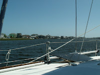
More fog this morning. Visibility is about 1 mile when boats start leaving the anchorage. We weighed anchor and start moving north about 0720. One bridge to clear this morning at Onslow Beach. It was a struggle and I ran the engine harder than I like to but we make it to the bridge in time for the 0800 opening. There were nine boats jockeying about waiting on the old swing bridge to finally get fully open and then everyone took off.


About a mile north of the bridge, the fog closed in and visibility drops to 150 yards. Suddenly nine boats came to a crawl. I had all my running/steaming lights on but cannot see any lights on the boats ahead. I can barely make out the shape of the boat ahead of me and I am thankful to be the last boat in line. This is definitely when having radar would be helpful.


After 0930, the fog began to clear a little and we picked up speed. We struggled against the current as we approach Bogue Inlet and Swansboro. We entered Bogue Sound where the channel is narrow but fairly straight. We got a little breeze and did some motor jibbing. We soon crossed the tide line and begin fighting the incoming tidal current from the inlet at Beaufort.


Around 1100 or so, the wind turned cool and began to pickup. Fog began coming in and obscured the Emerald Island and Bogue Banks to the south. As the fog rolled across the sound toward us visibility got less and less. When we finally reached the Atlantic Beach Bridge, we could not see the land mass to our south.


Things looked better as we approach Morehead City. From the big channel I saw two sailboats at the Sanitary Restaurant dock. That meant 2 of the 3 so called “free docks” were taken. Having learned our lesson on the last trip, we avoided the shoaled small northeast channel and took the main channel to the port area and round Sugar Loaf Island to the Sanitary.


Once docked we took a walk about town and explored the construction at the Municipal Dock area. The town is building a Shower/Restroom/Laundry facility next to the docks. This should make these docks another possible stopping area. We also checked out a few shops including a great upscale bakery/gourmet foods place.


After the walk we dined at the Sanitary to qualify for the “free” ($10) slip usage. Next door at a newly opened place called Jack’s, there was quite a Cinco de Mayo celebration going on. A live band, lots of hot rod cars, custom motorcycles, and a celebrity of sorts. Mikey Teutul from Orange County Choppers and the TV show “American Chopper” was there with some of their custom bikes.

Location: Sanitary Restaurant Dock, Morehead City, NC - MM 205
Distance Traveled: 39 mi

May 4, 2010 - Day 19


Light drizzle started about 0500 this morning and things went down hill from there. By the time it would have been getting light, fog settled in and visibility was way down. A check of the internet radars said more heavy rain was to come.

We decided to take the day off. We enjoyed a leisurely breakfast with a great omelet and lots of hot coffee. Later Donna worked on her art stuff while I made log entries.


Tomorrow is supposed to be better weather so we’ll try to make it to Morehead City or Beaufort. The sunset was beautiful and we were almost at the end of a rainbow. The marines continued their training operations way late into the night with helicopters flying and gunfire in the distance.


Location: Still Anchored in Mile Hammock Bay, NC - MM 244
Distance Traveled: None

May 3, 2010 - Day 18

We got a late, 0730, start today. I wanted to be underway at 0700 so we could time the bridges we had to transit. The late start caused us to arrive early/late at the Wrightsville Bridge. I tried dragging my heals by idling the engine back and even idled back and put the transmission in neutral. The wind was directly behind us blowing 18, gusting to 22. Add that to the favorable current and the boat was traveling at 4.3 mph with no engine or sail help.


Arriving at bridges with lots of wind and current is no fun. Heading into the wind/current with just enough speed to keep the boat near stationary is not too hard. But when you get inexperienced skippers or big powerboats who cant idle low enough, it becomes a dance of sorts as you try to maintain position and dodge boats out of control.


After getting through the Wrightsville Bridge, we played the same game again trying unsuccessfully to arrive just in time for the opening of the Figure Eight Island Bridge. After watching us jockey around for about 15 minutes in wind gusting 24, the bridge operator said he would try to open the creaky old swing span early. By the time he got it open, it was at the normal scheduled time.


The next bridge at Surf City was 18 miles away. The GPS estimated with our speed we would be either 20 minutes late or 40 minutes early depending on how you looked at it. No amount of sail trim and safe throttle could get us there any faster so we settled back and dragged our heals again.


When we got to our anchorage destination, Mile Hammock Bay, there were already 5 boats anchored. We found a spot and dropped the hook at 1630. The bay is a basin dredged out by the Marine Corps for use with Camp LeJune. By 1800 three more boats joined the anchorage making a total of nine boats (make that ten counting the permanent resident). Considering the high wind situation (20 gusting to 24) we all needed maximum swing room.


The wind stayed strong until sometime after 0130. The Rocna held firm with a 5:1 scope.

Location: Anchored in Mile Hammock Bay, NC - MM 244
Distance Traveled: 51 mi

May 2, 2010 - Day 17

This was going to be a short day as far as traveling was concerned. The plan is to ride the incoming tide up the Cape Fear River and through Snow’s Cut. We departed at 0930 (about 2 hours before high tide) and got out into the river. Once we were out in the current our speed jumped from 6.0 mph to 9.7 mph. It was an easy run over to Carolina Beach where we anchored about 1200.


Being for the first to arrive, we had the anchorage area to ourselves. Things were pleasant for a while and then the winds began to pipe up. At 1500, the wind was gusting to 25. Thankfully, the Rocna was holding firm according to the GPS.


Location: Anchored at Carolina Beach, NC - MM 295
Distance Traveled: 14 mi

May 1, 2010 - Day 16

We took it easy this morning and waited for the tide level to rise a bit. We were only going a short distance to Southport and I did not want to start the day by running aground on the bar going out the harbor or several of the inlets ahead. We got underway about 0930 and headed for two notorious troublespots, Shallote and Lockwoods Folly Inlets. These inlets were dredged recently, but are reported as shoaling again already.


We arrived a little early for the scheduled opening of the Sunset Beach Pontoon Bridge. It's another very old bridge being replaced with a new high rise span presently under construction. I wonder if it will stay in place after the new high rise is completed?


Our timing with the tide provides us with plenty of water and we transit the troublespots easily. It being the weekend, we were bothered more by the local traffic. Using the autopilot was near impossible as we got waked from both sides as boats literally flew by us in both directions.


The wind is really up and out of the SW so water depths seem to be below normal. This means anchoring in Dutchman Creek or the Pipeline Canal are out of the question. We head on to the limited anchorage in the old Southport basin and the free docks at the Provision restaurant. Unfortunately we are late arrivals and those areas are already filled by other boats. With our cheap choices exhausted, we contact Southport Marina and take a slip there for the night.


We are docked by 1500 and decide to use the remainder of the day for doing laundry and taking showers. While doing laundry, we encounter a couple of retired ministers we met in Stuart. They are doing the Great Loop on board a large houseboat. It was great to sit and talk with them again.


The evening was pleasant and we both fell asleep watching TV, then got up and went to bed for the night.


Location: Southport Marina, Southport, NC - MM 309 (N of Myrtle Beach, SC)
Distance Traveled: 37 mi

April 30, 2010 - Day 15

No overnight happenings to speak of but we had more fog this morning. In fact, at 0600 when I got up, I could only see the mast of the other sailboat sticking above the fog. We decided to have coffee and a regular breakfast while we waited for the fog to lift. The fog cleared out enough to hoist the anchor and get underway about 0815.

We continued our scenic tour of the Waccamaw until the ICW branched off into the cut toward Myrtle Beach and the Little River. The cut is narrower and littered with “blue collar pieces of heaven” and overstated opulence. Bridge operators at Socastee, Barefoot Landing and Little River did their best to slow us down by making us wait 10 to 15 minutes for each opening. These are tired old swing bridges and have all been replaced by nearby high rise bridges. I’m sure the justifications for building the new bridges included getting rid of these decrepit swing bridges. Why are they still in existence?

As we are departing Myrtle Beach we hear chatter on the VHF regarding the number of boats in the Calabash Creek anchorage. This was to be our destination but it was already crowded so we opted to stay at the Myrtle Beach Yacht Club.


The tide was low and water depths into the harbor basin were very skinny. Darn near heart stopping at one point. Even at the dock we were very close to sitting on the bottom. We refueled and prepped the boat for the next day and then hit the showers.


We were both a little tired so instead of fixing dinner, we decided to go to the Officer’s Club Restaurant. We were presently surprised. The atmosphere and food were great. We both had excellent meals. We had crab stuffed mushrooms, steak, and shrimp scampi,. We even decided to have desert and enjoyed a “Brownie Tower” with coffee. After the fabulous meal we walked a bit and then headed back to the boat near 2200.


It was a quiet evening dockside.

Location: Myrtle Beach Yacht Club, SC - MM 346 (N of Myrtle Beach, SC)
Distance Traveled: 43 mi

April 29, 2010 - Day 14

Big moon shining all night gave us a beautiful view of the anchorage. It also helped us keep our visual location reference points. Two other boats with us in the anchorage overnight, one trawler and one sailboat. The wind died way down late in the evening so we had a peaceful night. This morning however, we had a little bit of fog. I got these great pictures of the moon setting and the sun rising within minutes of each other. We delayed our start a little, but we were underway at 0815 headed for the scenic Waccamaw River and Myrtle Beach.
We got some boost from the current until we reached Winyah Bay. From there we fought the strong current coming down the Waccamaw. The wind was light and from dead astern until late in the afternoon. By the time the wind began to increase, we decided to stop short of our goal and anchor in Thouroghfare Creek to take advantage of the trees that provided some wind protection there.

We shared the anchorage with one other sailboat. We dropped the hook about 1615 and found out why its called “Thoroughfare”. There was lots of local traffic running between the Waccamaw River and the Great Pee Dee River plus the usual local fishermen, skiers and jet skis.

Thankfully, the wind and traffic died a little after sundown and we had a quiet evening.


Location: Thoroughfare Creek, SC - MM 389 (N of Georgetown, SC)
Distance Traveled: 47 miles